City of Los Angeles Employs GIS-Based BMP PLanning Tool
The City of Los Angeles has the challenge of managing the stormwater runoff from a highly urbanized 500-square-mile area. With this vast urban watershed to manage, the city must take advantage of the widest range of effective best management practices (BMPs) available. To help accomplish this end, the city wanted a tool to help predict the water-quality improvements that would result from various BMPs. The result–a GIS-based BMP planning tool.
Water-Quality Improvements
Municipalities across the country are under the mandate of the Clean Water Act to improve our nation’s waterways by reducing the quantity of pollutants that stormwater picks up and carries into storm sewer systems. Whether it is oil and grease from roadways, pesticides from lawns, sediment from construction sites, or carelessly discarded trash, these pollutants impair our waterways by impacting recreational use, contaminating drinking-water supplies, and interfering with fish and wildlife habitat.
Federal mandates on municipalities have become more stringent, progressing from a general emphasis on education to the imposition of very specific requirements. The current National Pollutant Discharge Elimination System (NPDES) municipal stormwater and urban runoff discharges permit contains the most extensive provisions to date. These include increased responsibilities for inspections and monitoring, and the implementation of programs to satisfy total maximum daily load (TMDL) regulations.
Since this permit was adopted by the Los Angeles Regional Water Quality Control Board in 2001, Los Angeles has been strategizing, planning, and implementing water-quality improvement projects for its 30 miles of channels, 1,200 miles of storm drains, and more than 34,000 catch basins.
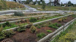
The city has developed and implemented a comprehensive stormwater control program for private and public sector development projects that specifies the use of BMPs to reduce pollutant discharges from municipal storm drain systems. The city’s BMP Handbook on the Standard Urban Stormwater Mitigation Plans outlines the required BMPs for specific development projects. Examples include reduction of impervious surfaces (through the use of such BMPs as permeable pavements), catch basin stenciling, efficient irrigation, slope/channel protection, vegetated swales, wetponds, vegetation strips, and extended detention basins.
To help with the management and implementation of the permit requirements, the city teamed with the County of Los Angeles to develop a GIS-based Pollutant Load Model. Developed by Psomas using ESRI’s ArcView software, the model is capable of predicting the pollutant load of over 250 pollutants for various storm events. It has proved to be a highly effective and timesaving tool, in one case reducing the time that would have been spent modeling a watershed by 90%. The city decided to add a BMP planning tool into the Pollutant Load Model to help make the best decisions in meeting the increasing demands of its water-quality improvement program.
Testing BMPs Within a Watershed
The development of the tool was grounded in the body of research about BMP effectiveness. Data from some 35 different types of structural BMPs and dozens of studies conducted throughout the nation were cataloged and summarized into a BMP matrix.
Information in the matrix included an overview of the BMP, performance data (pollutant removal percentages) for a variety of urban runoff–type pollutants, maintenance requirements, costs (both capital and operations and maintenance), and a complete overview of benefits and constraints associated with the BMP. Other information included effluent concentrations, treatment flow capacity, drainage area, hydraulic issues, soil type requirements, slope issues, right-of-way issues, groundwater depth limitations, and groundwater contamination potential.
Using the BMP planning tool, the user can test several BMPs within a watershed and model the reduction in a set of target pollutants. The user selects an outfall or specific location of interest, selects a number of target pollutants to study, selects a rainfall intensity, and then graphically places BMPs within the watershed. The tool identifies the tributary area to the selected location, calculates the existing pollutant load without any proposed BMPs, recalculates the load based on the test set of BMPs, and summarizes the reduction in loads for each pollutant. Several assumptions were required: All waters from the sub-basins pass through the BMP, the BMP is sized and installed properly, and the installation has addressed all constraints for that BMP location.
Current and Future Uses
Since its completion in May 2004, city staff has used the BMP planning tool for a variety of purposes:
- Comparing a variety of structural BMPs to understand their effectiveness in addressing several of the TMDL regulations
- Evaluating many different BMP combinations to address specific pollutant concentrations in several targeted areas of the city with known water-quality issues
- Testing the predicted effectiveness of BMP placement within a targeted watershed
- Evaluating the water-quality conditions downstream of proposed BMPs
Based on the experience gained to date, the city plans to further use the tool to
- evaluate whether existing, recently installed controls are sufficient to address water-quality requirements, and if not, what additional controls may be needed;
- track and display specific BMP monitoring efforts to help establish field performance data; and
- calibrate and update the BMP effectiveness table with specific water-quality monitoring results.
Although the city has been using the tool for just over a year, staff members already have found it to be highly valuable in evaluating a range of potential water-quality improvements. Water-quality mandates will undoubtedly get more stringent in the future. With the BMP planning tool, Los Angeles is well prepared to carry out its watershed management responsibilities in a highly effective, technically sound, and cost-effective way

