Conservation Subdivisions: More Than Just a Stormwater Tool
As development costs are skyrocketing and issues like water quality, NPDES, and protection of sensitive areas are coming more to the forefront than ever before, design engineers and developers alike are looking for cost-effective solutions to their development woes. Conservation subdivisions may be an alternative that yields the same number of lots within the development while protecting floodplains, wetlands, and riparian buffers; reducing impervious surfaces; minimizing stormwater runoff; and effectively treating what stormwater that is generated within the development in the open spaces created within the project itself.
As defined by the New Hampshire Department of Environmental Services, a conservation subdivision is “an alternative form of residential development where, instead of subdividing an entire tract into lots of conventional size, a similar number of housing units are arranged on lots of reduced dimensions, with the remaining area of the parcel permanently protected as designated open space. It is also referred to as an “˜open space subdivision.'”
Pennsylvania with its Growing Greener: Conservation by Design initiative, North Carolina with its Green Growth Toolbox, and New Hampshire are some of the states that are already ahead of the curve on this win-win design concept. Basically, land-use regulations are set up to define conservation subdivisions as having a minimum overall project area and also preserving a set percentage of the overall project as permanently protected open space. This land, which may be up to 50% of the project area, usually exists, in its current predeveloped state, as floodplains, wetlands, and riparian buffers, but can also take the form of habitat for threatened or endangered species; habitat protected by a Wildlife Action Plan; wildlife corridors; scenic view sheds; historic, cultural, or archeological areas; areas with high water tables; or areas that are otherwise unsuited for development, or any area, such as highly productive woodlands or agricultural areas, that the community wants to protect in perpetuity. The protection can come in the form of deed restrictions or perpetual conservation easements held by the developer, the homeowner’s association, or a third party such as a land trust or conservation agency, and run with the property (and its successors and assigns). Some communities desire, or even incentivize, certain amenities within the newly preserved open space, such as walking trails, while other communities wish for the preserved area to be left pristine and unspoiled.
The “incentive,” if you want to call it that, for the developer is generally the ability to be able to construct the same number or close to the same number of lots (based on a formula set up by the community), that would have originally been developed had the open space not been preserved. There really isn’t an incentive needed at all, however, because the benefit of this kind of development lies in the reduction of the length of roadway surfaces and the associated curb-and-gutter or raised-edge asphalt costs (or the elimination of these altogether); the reduction of water, sewer, and other related utilities’ installation (again, there are shorter runs of service lines); the reduction in other impervious surfaces such as sidewalks and driveways; and the massive reduction in stormwater pipes and ponds, if not the outright elimination of most or all of the stormwater detention ponds.
Obviously, impacts on the environment, especially on water resources, are drastically reduced by minimizing land disturbance and reducing the amount of impervious surface. The open space can also serve as a filtering and infiltration area for the subdivision’s stormwater runoff, not to mention a buffer for nearby ponds, wetlands, and similar water bodies.
Greater still for anyone wishing to locate in one of these subdivisions is the financial gain realized in increased property values within conservation subdivisions, especially in those lots immediately adjacent to the preserved open space, the recreational opportunities that can be a part of these open spaces, and the view sheds often created by all of that unspoiled environment. It has also been found that the clustering of homes within the subdivision can encourage walking and more frequent interaction with the subdivision”˜s neighbors, fostering a stronger sense of community or what is described by many as a “sense of place” among the residents living there.
Let’s go back to the stormwater implications for just a minute. Efficient stormwater management techniques are intended to reduce the damaging impacts of stormwater runoff on water quality, on flooding, and on sensitive ecosystems impacted by all of that water. Polluted runoff is the single leading source of stream impairment within the United States, also causing harmful and negative impacts to terrestrial plants and resource dependent animals. In short, many regions’ aquatic systems, including the animal life found there, are threatened by today’s inadequate stormwater management practices and the degradation may potentially cause the loss of sensitive ecosystems and several specifies of wildlife, if left unchecked.
With that in mind, the integrity and the quality of our nation’s stormwater management needs to be at the forefront of every community’s watchdog list. Obviously, the growing problems with stormwater runoff are in direct proportion to the amount of impervious surfaces that are being built and the amount of soil-compacting construction activities that are taking place in our communities. Meteorologist Jacques Jeras described it quite adequately after the Metro Atlanta flood in 2009, terming it the “concrete jungle” where “the water runs very fast.” Water runoff as described here cannot effectively recharge groundwater, resulting in less available drinking water and causing flooding with all of its obvious damaging effects. Less noticeable to the general public are the high and low flow cycles in streams and wetlands, normally dependent on fairly stable flows to thrive, which result in loss of stream habitat and stresses to fish and other aquatic wildlife. Worse still, stormwater runoff is often contaminated with various water pollutants that are byproducts of urban and suburban activities such as construction, automobile use, and lawn care practices. Additionally, reduced baseflows can cause small streams and lakes to dry up and reduce the streams’ ability to dilute pollutants. If left unhindered, the pollutants can further stress fish and other wildlife species that depend on clean water for food and habitat.
Effective stormwater management needs to accomplish two things: slow stormwater runoff and ensure stormwater quality so it does not harm vital ecosystems within our communities. As more stringent regulatory standards for stormwater management face our development community, local governments can “green up” their regulatory process by adopting laws, ordinances, regulations, and internal procedures that promote effective stormwater management and protect the natural environment at the same time. These regulatory processes can and should include the use of conservation subdivisions.
Nathan Walker, formerly a community planner for the Natural Lands Trust in Media, PA, and now with AMEC, tells us that “the best BMP is not to need one.” He also points out the nonstructural stormwater management methods from Pennsylvania’s Growing Greener model that site designers can use when developing conservation subdivisions:
- Minimize clearing, grading, and compaction. Conservation subdivisions limit earth disturbance, depending on the community, to as much as 50% of the site. Although some land included in the open space may require some minimal grading if it is used for recreational areas or absorption fields (as allowed by the specific community), the bulk of each conserved or open space area is not disturbed.
- Sensitive feature protection. Wetlands, floodplains, and other sensitive areas are set aside as required open space early in the planning process.
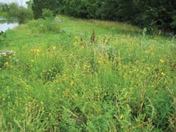
- Woodland and meadow preservation. These areas can be used as groundwater recharge areas.
- Protect and maintain streams and wetlands. Riparian buffer management Plans can outline management of invasive species and habitat restoration for degraded areas. Ongoing maintenance is agreed upon to ensure that the riparian buffer maintains its function to filter runoff and shade streams.
- Less impervious cover per unit. When land is developed in a compact way, impervious cover per unit often decreases as roads and driveways are shorter. This is the result of the compact development pattern, reduced front yard setbacks, and smaller lot widths that are found in conservation subdivisions.
- Reduce street width and length. Properly scaled streets and alleys can reduce impervious cover, reduce speeds, and increase safety.
- Manage runoff at its source. The incorporation of internal village greens, tree lawns, and depressed cul-de-sac islands, as promoted by Growing Greener, adds to the aesthetic of conservation subdivisions and can be designed to reduce the amount of runoff that becomes concentrated.
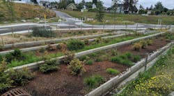
Conservation subdivisions can also utilize other BMPs in their overall stormwater design and management system, on top of the obvious benefits of all of that open space. Rain gardens can be used on individual lots. Collection and treatment areas can be used in green areas within cul-de-sacs, along roadways in swales, and in community common areas, such as entrances and parks. Bioretention areas can capture and treat stormwater runoff throughout the subdivision. In fact, a community wide network of open spaces within conservation subdivisions can treat and infiltrate stormwater while providing passive recreation for the residents living there. It’s about using the right combination of techniques, in the right places, at the right time, to achieve the right results.
Preserved open spaces within conservation subdivisions can make subdivisions more enjoyable and sustainable places to live and recreate. They not only preserve land and enhance aesthetics within the community but also provide for more efficient stormwater management, often dramatically driving down the cost of stormwater infrastructure installation and maintenance. At the same time, these conserved open spaces and their natural ecosystems provide a huge return in flood control, increased water quality, enhanced groundwater recharge, promotion of nutrient cycling, erosion control, to name a few of the many long-term benefits. Maybe the most important quality of conservation subdivisions is that they allow residential living to coexist with nature, so that a community’s natural heritage is preserved for the enjoyment of current residents and that the environment is protected for future generations to come.


