Stormwater Management in Coastal North Carolina
“There are three reasons for us to do a stormwater project. One is to fix a flooding problem. Nine out of ten citizens would say this is the main reason. Two is to improve water quality,” says Dave Mayes, Stormwater Services Division manager for the city of Wilmington, NC.
“Three, we have a disjointed system. Part of it is under our control and part goes into private property. We want to develop a connected system, so with stormwater projects we can connect the dots.
“Every project we do relates to one or more of these factors, and if we do all three we’ve hit a home run,” he says.
Located in coastal southeastern North Carolina, Wilmington has a population of 112,067 (2010 census). In 2014, Wilmington celebrated the 275th anniversary of its existence.
City residents live between the Cape Fear River and the Atlantic Ocean. Four beach communities—Wrightsville Beach, Fort Fisher, Carolina Beach, and Kure Beach—are within half-hour drives of downtown Wilmington.
During the Civil War, the city’s port played a critical role in supplying the troops and citizens of the Confederacy. Blockade runners—epitomized by Rhett Butler in Gone With The Wind—risked Union Army artillery for great profit. So well defended was Wilmington that it didn’t fall into Union hands until two months before the war had ended.
Wilmington’s connections to the Revolutionary and Civil Wars and its proximity to beaches make tourism an important part of the local economy. Another area attraction and economic contributor is commercial and recreational shellfishing.
Untouched coastal landscapes in southern climates produce very little runoff. They have several built-in ways to reduce the volume of water and the pollution it carries. First is sandy soil that absorbs and filters runoff quickly.
“Our soil is so sandy that we get 20 inch per hour infiltration. [Runoff from] a two-and-a-half-inch storm in 24 hours never touches the street,” says Jonathan Babin, stormwater manager for Wrightsville Beach.
Plants that thrive in warm weather most of the year also absorb and filter stormwater. Finally, the heat evaporates runoff much more quickly than it can be evaporated in colder climates.
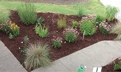
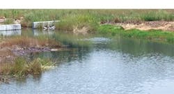
Rain garden at 9th and Ann Streets
But it’s the natural beauty of untouched coastal areas that attracts people and makes them want to settle there permanently. That means, of course, inevitable stormwater problems from more roads and roofs and other impervious surfaces. Such is the case with Wilmington and adjacent areas.
Mayes sees two primary challenges for stormwater management in the area. “We’re getting above-average rainfall, 50 to 55 inches of rainfall per year. We get more volume of rain in storms, and the intensity is pretty high—a lot of rain in short duration.”
He adds, “Combine that with very flat slopes. We have no ravines or steep hills. Water likes to hang out a lot longer, so we can’t move water from areas as quickly as you can in the Piedmont or mountainous areas [of North Carolina].”
“It’s unlike point-source pollution. It’s everywhere, and its pathways are more direct, says Tracy Skrabal, coastal geologist and manager of the North Carolina Coastal Federation’s southeast regional office in Wrightsville Beach. “It’s the challenge and it’s also the objective, to disconnect the connections stormwater has [so that it will infiltrate onsite].”
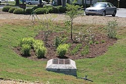
This rain garden at Tidal Creek is a city stormwater project, part of the Grey to Blue program.
Skrabal adds, “Even though we’re a small town, we’re heavily populated. We’re surrounded by water everywhere—the river, tidal creeks, the ocean.”
On the plus side, she notes, “Our residential areas are very sandy and able to infiltrate stormwater well. With the correct application they are usually successful. We don’t have the difficulty [in infiltrating runoff] that you have in areas that have clay soils.”
Wilmington has a stormwater utility in place for both residential and commercial properties. There is no consent decree, but Wilmington and surrounding communities are working together to implement a long-term plan to restore the quality of impaired waters so that shellfishing areas can be reopened.
As for green infrastructure in stormwater projects, Mayes says, “We’re trying to incorporate it, and we’re at the beginning stages.”
One successful green infrastructure project in Wilmington is the Wade Park Wetland. It was a $4 million joint project by the city of Wilmington, New Hanover County, and the state of North Carolina. The 17-acre park is on the site of a former wastewater treatment plant. Before the plant was constructed, the area was a natural wetland.
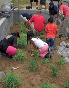
North Carolina Coastal Federation rain garden
Completed in 2007, the wetland at Wade Park helps clean stormwater before it runs into the Hewletts Creek watershed and also reduces flooding in the area. The largest wetland in the area, it receives runoff from 590 acres, which is about 10% of the Hewletts Creek watershed.
The project began when New Hanover County bought the land in 2005 with money provided by the North Carolina Clean Water Management Trust Fund (CWMTF). Wilmington’s Stormwater Services Division installed the 12-acre wetland starting in 2006. The project diverts runoff from two outfalls bordering the property into the wetland before the water enters Hewletts Creek.
The Wade Park Wetland also provides habitat for native and migratory birds and animals. The remaining 5 or so acres of the land were made into a public park after the wetland was completed.
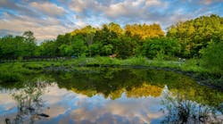
Wade Park Wetland
The city of Wilmington and its nearby beach towns are fortunate to have the University of North Carolina at Wilmington close. Dr. Michael Mallin, professor of biology and marine biology, works with the city, the North Carolina Coastal Federation (NC Coastal Federation), and other entities on stormwater issues.
Mallin led monitoring efforts in 2009 and 2010 to see how well the Wade Park Wetland was handling stormwater volume and pollution. According to a study first published in the November 5, 2012, issue of the Journal of Environmental Quality, the results were quite favorable.
The sampling covered eight storms and showed that the Wade Park Wetland retained and/or removed 50 to 75% of the inflowing volume of runoff. The average load reduction for fecal coliform bacteria was 99%, with an overall concentration reduction of more than 90%.
Another green infrastructure project in Wilmington involved converting city property into an operations center for the Street Sweeping Division of the Public Works Department. Solar panels added to the roof eliminated almost all the power bill for the center.
“A portion of that property directs runoff to a new bioretention area, about three-quarters of an acre, and that’s in a very industrial area,” says Mayes. “Previously stormwater just sheeted off. Now it infiltrates.”
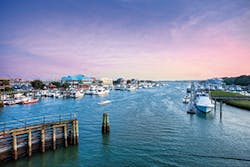
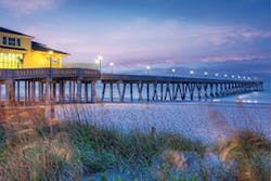
Pier at Wrightsville Beach
About 10 miles from Wilmington is the town of Wrightsville Beach. It is on a narrow island several miles long, which is connected to the mainland. One of several barrier islands, it lies between the Intracoastal Waterway and the Atlantic Ocean.
Wrightsville Beach stormwater officials team up with their counterparts in Wilmington.
They also work closely with the NC Coastal Federation, North Carolina State University, the University of North Carolina at Wilmington, and other agencies.
In this section of coastal North Carolina, pollution carried by stormwater runoff has closed shellfishing waters, some for years. Periodically—usually after a big storm—swimming areas off Wrightsville Beach and other places are closed. Mayes says results from lab tests allow these beach areas to reopen for swimming in less than 48 hours, but the closures interfere with tourists and residents alike.
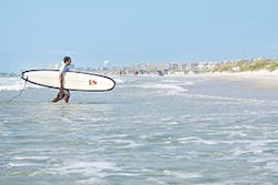
Wrightsville Beach
“People want to come here for shellfishing, swimming, boating, all sorts of recreational activities. Livelihoods depend on it, so our waters need to be clean,” says Mayes.
Skrabal says, “Wrightsville Beach is a real destination for athletic events, especially triathlons and swimming events. People are exposed to the water, so there is increasing attention to it and the desire to get [rid of]
polluted water.”
Realizing how much damage the posted closings of swimming and shellfishing waters were doing to the local economy, stormwater officials and their partners devised a plan to gradually improve water quality in the Bradley Creek and Hewletts Creek watersheds.
The agencies and municipalities involved were able to skip the usual costly and time-consuming total maximum daily load (TMDL) pollutant study usually needed before such a cleanup plan can be devised. With no industry in the area, it was obvious that stormwater runoff was the source of pollutants entering the nearby waters.
Rather than trying to reduce pollution and runoff volume, the Water Quality Recovery Plan focuses solely on reducing volume. Given the lack of industry in the area, if there is less volume of stormwater, there will be less pollution to reach receiving waters. That, they decided, is the quickest approach to make shellfishing safe again.
The voluntary Water Quality Recovery Plan is known as Grey to Blue. It was modeled on Portland, OR’s Grey to Green program.
The final version of the plan was approved in August 2012. It will take years to implement all of the projects and return the shellfishing waters to the much cleaner state they were in 30 or so years ago.
“We did a large investigation of the Bradley Creek and Hewletts Creek watersheds and concluded that we could reasonably assume that we could bring the volume of stormwater back to the 1980s level,” says Skrabal.
Interim goals are to improve the impaired waters back to the levels of pollution in 2010, 2006, 2002, and 1998. BMPs will be implemented in the order of how best and quickest to meet these goals by reducing the volume of stormwater runoff.
Skrabal adds, “We want to improve water quality in declining areas and preserve good water quality where we still have it.”
“The whole end game is to [be able to] open the shellfish areas again,” explains Babin. “If the shellfish waters are clean, then the water is clean enough for swimming.”
The North Carolina Department of the Environmental and Natural Resources (NCDENR) “comes every Monday and tests the water at eight different sites,” says Babin.
Swimming advisories are most often posted after a big storm. Birds account for the main type of bacterial pollution. Wrightsville Beach has two bird sanctuaries that attract wild birds.
“Sand is like a wet petri dish,” says Babin. “Bacteria multiply in rainwater, and the drains [they’re washed into] are heated by the roads.”
Making the impaired waters safe enough for shellfishing again requires cleaning two watersheds that drain from Wilmington and Wrightsville Beach. The Bradley Creek and Hewletts Creek watersheds are adjacent to each other. Both creeks drain directly into the Intracoastal Waterway.
Currents in both watersheds are influenced by tides that rise and fall through the Masonboro Inlet twice a day. These creeks are not only the largest and most developed tidal creeks, but also some of the most polluted.
The North Carolina Division of Marine Fisheries identifies both Bradley Creek and Hewletts Creek as Primary Nursery Areas. They are essential for a healthy population of numerous varieties of fish for both commercial and recreational fishing in the state.
Both watersheds are heavily developed. Bradley Creek has impervious surface coverage of 23%. About 19% of the Hewletts Creek watershed is impervious.
Bradley Creek drains an area of 7.2 square miles directly into the Intracoastal Waterway. This drainage area includes most of the UNC Wilmington campus. Almost 85% of the watershed is developed, with an estimated population of 14,780 people.
Residential is the most prevalent land use in the watershed, followed by office and institutional use. About 46% of the land area in the Bradley Creek watershed that is within 1,000 feet of the creek—that is, the closest to it—is residential.
Hewletts Creek also drains into the Intracoastal Waterway, but from a larger area, about 11.6 square miles. Almost 85% of this watershed is developed, and it contains an estimated population of 24,746 people.
Residential is the most prevalent land use in the watershed. About 44% of the land area in the Bradley Creek watershed within 1,000 feet of the creek is residential. The goal of the plan is the gradual improvement of water quality in the two watersheds.
This future positive trend in water quality will be apparent as swimming advisories within the Bradley Creek watershed along Banks Channel are posted less and less often. Another indicator that the tide is turning against water pollution in receiving waters from this watershed will be the expansion of shellfish-growing areas.
For the Hewletts Creek watershed, improvements in water quality will show first in waters being upgraded from “Prohibited” to allow temporary openings for shellfish harvesting. In later years, as more waters become safe and remain so, signs in the shellfishing areas will proclaim a permanent status of “Approved” for harvesting.
Skrabal and other NCCF staff members work closely with officials in Wilmington, Wrightsville Beach, and elsewhere on stormwater and other projects that protect and benefit North Carolina’s coastal communities. NC Coastal Federation secured funding from the National Estuarine Research Reserve Service to retrofit a number of green infrastructure BMPs in Wrightsville Beach. These projects advance the goals of the long-term Water Quality Recovery Plan. One such project is along Iula Street.
This project includes approximately 150 linear feet of 42-inch by 29-inch perforated elliptical aluminum pipe along an existing outfall pipe. The perforated pipe works as an infiltration chamber. It allows stormwater runoff to infiltrate the natural sandy soils before it can flow to Banks Channel. The drainage area is about 1.8 acres, about 90% of it impervious.
The system is heavily influenced by groundwater and tide levels. If the tide is low when a storm hits, all of the runoff from a one-year storm event can potentially infiltrate.
“The Iula Street project is like a giant French drain,” says Babin. “The bacterial load reduction is amazing. Stormwater never reaches Banks Channel [from there now]. It keeps us an island.”
The most complex system, located adjacent to Banks Channel waters, involves an innovative design that disconnects street runoff from one of a number of stormwater outfall pipes along Waynick Avenue, and instead allows it to be stored within an infiltration chamber and slowly soak into the ground through a series of perforated pipes.
Another BMP project is the rain garden that was installed at the intersection of Municipal Lane and Salisbury Street. Its prominent location ensures that many people will learn about this BMP. Native plants installed include joe-pye weed, black-eyed Susan, swamp milkweed, blue flag iris, purple coneflower, and pickerelweed.
Runoff from an impervious area of 17,500 square feet drains to the rain garden. This green infrastructure project reduces 62% of the runoff from a one-year storm event. Water that previously was piped into the sewer system is now infiltrated.
“Most of these demonstration projects are not highly technical, but they have profound effects on water quality. You can remove 90 to 95% of all pollution by removing the volume of stormwater,” says Skrabal.
Another BMP project in this first group is an earthen check dam on the roadside along Salisbury Street. There is already a swale there, but this dam will slow runoff so that it has time to infiltrate. The reduction of runoff is equal to that of an entire one-year storm event. The area drained measures 4,500 square feet.
New inlets on Causeway Drive in front of the soccer fields will divert runoff from 10,000 square feet of road to a landscaped area near the soccer fields. Further along Causeway Drive, other new inlets will divert runoff to a grassy area between it and the arboretum. Runoff that now flows into the storm sewer system will be infiltrated. Curb cuts will direct road runoff into the median between the inbound and outbound lanes of Causeway Drive. The drainage area covers 8,700 square feet.
Landscaping in front of the Mellow Mushroom (a pizza parlor) will be regraded to provide additional infiltration. The drainage area involved covers 8,700 square feet.
The NC Coastal Federation is one organization that not only talks the talk, it walks the walk. That awareness of water-quality problems and solutions is clearly demonstrated at its southeast regional office in Wrightsville Beach. The office is located on
The Loop—a 2.5-mile walking, running, and skating path that attracts both visitors and residents. The Loop circles past beach cottages, parks, and the town’s business district. The Loop even has its own Facebook page where people post pictures of surfers and sunsets taken while they were traveling along it.
“Over 300,000 people go past our center each year,” says Skrabal. She adds that NC Coastal Federation takes advantage of this opportunity to educate people about stormwater and protecting beaches and waterways.
The office itself is housed in an authentic Sears 1948 Craftsman Classic Beach Cottage home, recycled from another nearby island. Both a barge and a truck were required to move the former house to its current location.
Not only does NC Coastal Federation educate passersby through signage, it engages them. Every morning a staff person fills a green plastic watering can and places it beside sections of permeable sidewalk. A sign invites people to pour out some water and watch what happens.
Skrabal says that passersby, especially children, do just that. All of them seem to be surprised at how quickly the water infiltrates.
“We reuse or infiltrate 100% of our stormwater,” says Skrabal. “Our downspouts are all captured.”
The NC Coastal Federation building has 10 different BMPs for visitors to observe and learn from. Skrabal says, “We’re providing tangible ways to do the right thing. For us, it’s a win-win situation.”
Visitors can see a 1,100-gallon cistern. Water from this cistern is used for irrigation and to wash vehicles and equipment. Other stormwater BMPs include pervious walkways and parking areas by Pervious Solutions, two rain barrels, and a pervious infiltration trench chamber supplied by ACF Environmental and installed by Coastal Stormwater Solutions.
ACF also supplied permeable interlocking grass- and pebbled-filled pavers and interlocking concrete pavers, which were also installed by Coastal Stormwater Solutions.
Skrabal says that the NC Coastal Federation’s work has an additional target beyond persuading people who learn about BMPs at the headquarters building on The Loop to add green infrastructure to their properties. This target fits into NC Coastal Federation’s mission to protect coastal waters.
“We want to encourage large users such as DOTs [departments of transportation] in every state to incorporate these relatively simple, low-cost green stormwater projects whenever they design roads, parking lots, and so on, instead of doing them as retrofits.”
She adds, “It’s cheaper, and they all have a federal mandate to clean up the water.”
