LiDAR is a remote-sensing technology similar to radar. A hybrid of “light” and “radar,” it is also written lidar, Lidar, or LIDAR since consensus on its status as a word or acronym is yet to be reached. While radar uses radio waves, LiDAR measures distance and color by illuminating a target with infrared laser pulses—up to 150,000 per second—and analyzing the reflected signal. LiDAR technology was developed soon after lasers in the 1960s, and now its decreasing costs and higher precision are making it more appealing for a variety of uses from military and transportation, to meteorology and agriculture. LiDAR can be stationary (ground-based) or airborne with aircraft-mounted equipment. Airborne LiDAR surveys provide continuous coverage over all types of terrain and large areas.
LiDAR is a remote-sensing technology similar to radar. A hybrid of “light” and “radar,” it is also written lidar, Lidar, or LIDAR since consensus on its status as a word or acronym is yet to be reached. While radar uses radio waves, LiDAR measures distance and color by illuminating a target with infrared laser pulses—up to 150,000 per second—and analyzing the reflected signal. LiDAR technology was developed soon after lasers in the 1960s, and now its decreasing costs and higher precision are making it more appealing for a variety of uses from military and transportation, to meteorology and agriculture. LiDAR can be stationary (ground-based) or airborne with aircraft-mounted equipment. Airborne LiDAR surveys provide continuous coverage over all types of terrain and large areas. [text_ad] Previous AGRC projects in 2006 and 2011 captured LiDAR data at 6.6- and 3.3-foot horizontal resolution in parts of northern Utah. Still, no complete dataset of sufficient detail was available for the entire Wasatch Front, where robust data were needed most. Tarin Lewis, a project manager at Quantum Spatial (formerly Watershed Sciences Inc.) in Portland, OR, agrees that finer data were needed. The previous dataset was valuable, she says, “but there is a limitation for further analysis.” A new, more detailed LiDAR project would benefit several users, says AGRC’s Rick Kelson. The Utah Geological Survey and US Geological Survey (USGS) were interested in mapping geologic hazards, particularly the Wasatch Fault, before they are built over. The Utah Division of Emergency Management and the Federal Emergency Management Agency (FEMA) needed information for their Risk Mapping, Assessment, and Planning program. The USGS wanted to update its 3D Elevation Program and The National Map. Surveyors, planners, researchers, and developers were interested in updated topography, as were the Salt Lake County Surveyor’s Office and partner cities. Water engineers and utility professionals were also eager to use the data, which would be free to the public. “There is a strong trend towards mapping our current environment as accurately as possible in order to better understand how potential future changes will impact our lives and natural resources,” says Lewis. “It was great to see a large group of stakeholders come together to fund such a project and decide to offer the data publicly.” During 2013 and 2014, AGRC undertook an ambitious program to collect high-resolution surface data along the Wasatch Front. With the support of the aforementioned partners and Quantum Spatial, AGRC acquired 1,422 square miles of surface data with airborne LiDAR. The project covered Salt Lake Valley, Utah Valley, and additional areas along the Wasatch Fault from Gunnison, UT, to Malad City, ID. USGS conducted quality control before the data were published in September 2014. The purpose of this process was to ensure that the data sets met rigorous standards and were of sufficient quality for public access and scientific analysis. “Data acquisition, and all derivative products, met or exceeded all specifications,” the project’s final report says. [text_ad use_post='27767'] Available products include bare-earth DEMs, first-return digital surface models (DSMs, which include buildings and trees), intensity rasters, and laser point clouds. DEMs and DSMs have a 1.6-foot horizontal resolution and 2.5-inch vertical accuracy when compared with ground control surveys. Derivative datasets such as contours, hillshades, and slopes can be generated with GIS or CAD software. The new data would be “put to work for a diverse set of uses,” an AGRC news release predicted, including “modernization of flood hazard maps, fault studies, transportation project design, infrastructure mapping, solar energy quantification, and tree and vegetation studies.”Previous AGRC projects in 2006 and 2011 captured LiDAR data at 6.6- and 3.3-foot horizontal resolution in parts of northern Utah. Still, no complete dataset of sufficient detail was available for the entire Wasatch Front, where robust data were needed most.
Tarin Lewis, a project manager at Quantum Spatial (formerly Watershed Sciences Inc.) in Portland, OR, agrees that finer data were needed. The previous dataset was valuable, she says, “but there is a limitation for further analysis.”
A new, more detailed LiDAR project would benefit several users, says AGRC’s Rick Kelson. The Utah Geological Survey and US Geological Survey (USGS) were interested in mapping geologic hazards, particularly the Wasatch Fault, before they are built over. The Utah Division of Emergency Management and the Federal Emergency Management Agency (FEMA) needed information for their Risk Mapping, Assessment, and Planning program. The USGS wanted to update its 3D Elevation Program and The National Map. Surveyors, planners, researchers, and developers were interested in updated topography, as were the Salt Lake County Surveyor’s Office and partner cities. Water engineers and utility professionals were also eager to use the data, which would be free to the public.
“There is a strong trend towards mapping our current environment as accurately as possible in order to better understand how potential future changes will impact our lives and natural resources,” says Lewis. “It was great to see a large group of stakeholders come together to fund such a project and decide to offer the data publicly.”
During 2013 and 2014, AGRC undertook an ambitious program to collect high-resolution surface data along the Wasatch Front. With the support of the aforementioned partners and Quantum Spatial, AGRC acquired 1,422 square miles of surface data with airborne LiDAR. The project covered Salt Lake Valley, Utah Valley, and additional areas along the Wasatch Fault from Gunnison, UT, to Malad City, ID.
USGS conducted quality control before the data were published in September 2014. The purpose of this process was to ensure that the data sets met rigorous standards and were of sufficient quality for public access and scientific analysis. “Data acquisition, and all derivative products, met or exceeded all specifications,” the project’s final report says.
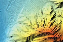
Available products include bare-earth DEMs, first-return digital surface models (DSMs, which include buildings and trees), intensity rasters, and laser point clouds. DEMs and DSMs have a 1.6-foot horizontal resolution and 2.5-inch vertical accuracy when compared with ground control surveys. Derivative datasets such as contours, hillshades, and slopes can be generated with GIS or CAD software.
The new data would be “put to work for a diverse set of uses,” an AGRC news release predicted, including “modernization of flood hazard maps, fault studies, transportation project design, infrastructure mapping, solar energy quantification, and tree and vegetation studies.”


