USGS Launches New Coastal Change Hazards Website
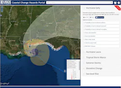
The US Geological Survey has launched a new Coastal Change Hazards website focused on coordinating research and delivering tools needed by coastal communities to respond to natural hazards along America's coastlines. USGS’s Coastal Change Hazards (CCH) brings together expertise, technology, and communities to help understand and reduce risks associated with coastal change.
Extreme storms are one cause of coastal change, but not the only one. Coasts are dynamic places and changes to these environments are ongoing, inevitable, and include wave impacts to cliffs, centuries of sediment transport and runoff, and the ever-present forces of wind and waves continually shaping coastal areas over millennia. USGS science helps identify the hazards and forecast changes in order to help reduce risk and inform planning and decision-making.
“The USGS Coastal and Marine Hazards and Resources Program supports scientists who are working strategically to harness new technology and integrate science from different disciplines and partners so that we can provide information, tools, and forecasts that help describe hazards and risks to human infrastructure and natural systems,” says the program’s coordinator John Haines. “By bringing these capabilities together, we can better help decision-makers weigh options on how best to protect lives, property, and the value our coasts provide.”
“The USGS has been studying coastal processes and changes for a very long time, but now we are taking a nationally consistent approach to connect that research with societal needs,” says Hilary Stockdon, Research Oceanographer and lead Science Advisor for CCH. “CCH is working to ensure that USGS tools and products—from historical trends in coastline change to forecasts of impacts from extreme storms and changes in coastal habitat—are available everywhere. By coordinating expertise and capabilities within the Coastal and Marine Hazards and Resource Program and across other USGS programs, we can both advance our fundamental understanding of coastal hazards and deliver useful science to the communities that need it.”
USGS monitoring of shorelines before, during, and after storms informs emergency managers on evacuation mandates and storm recovery planning, which can help to alleviate risk and loss from storms. One of the many successful tools created by CCH is the Total Water Level and Coastal Change Forecast viewer, developed and provided in close collaboration with the National Oceanic and Atmospheric Administration (NOAA), which provides hourly predictions of high water levels at the shoreline, giving users much-needed advance notice of the potential for local flooding and coastal erosion hazards on sandy coastlines around the US.
For more information on the Coastal Change Hazards website, visit the USGS website.