About the author: Paul Stenzler is vice president of sales for Cues Inc. Stenzler can be reached at [email protected] or 800.327.7791.
When El Paso Water Utilities (EPWU) in Texas received the responsibility of maintaining the city of El Paso storm water system, it inherited paper maps that required updates on inventory, GPS location and additional detailed data pertaining to the condition assessment of the storm water lines, manholes and dropped inlets.
| EPWU inherited a paper map-based sewer system. |
Jose Granillo, GIS manager for EPWU, worked with his team to evaluate the best methods to accomplish the tasks. Initially, they considered using their existing fleet of CCTV inspection and cleaning trucks; estimated production with this method totaled four or five assets per day. It was decided that this equipment would be better utilized performing standard daily workloads of traditional CCTV inspection and pipe cleaning.
New Vision
After careful deliberation, Granillo and Arturo Quijano contacted Paul Stenzler, vice president of sales at Cues, Orlando, Fla., to discuss the possibility of utilizing the company’s QZII Fast Zoom Pole Camera in tandem with a pickup truck equipped with a GPS locator and winch. The concept was to equip the pole camera with a wireless interface to a laptop computer that would be mounted in the cab of the pickup truck.
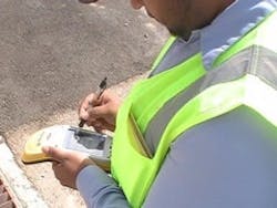
The pole camera would offer voice over, built-in image stabilization and distance and depth measurement. The operator would be supplied with an ANSI-rated safety vest containing a digital recording device with a flash drive and USB output, a local LCD display and battery pack. Still images of key observations would be captured as required.
Granillo’s objective was to create a system that could be quickly deployed from the utility truck, with the goal of inspecting and mapping 50 to 60 assets per day using the QZII, a GPS unit and a winch. The winch would be used to remove manhole covers and grates. The camera would be deployed to determine the depth, diameter, location and condition assessment of the dropped inlet, manhole or storm water line. Furthermore, it would define the direction of the line while wirelessly transmitting a real-time video to the laptop mounted in the cab of the truck. Results would include a picture of the manhole or dropped inlet, as well as a map indicating direction of the line. The GPS unit would log the GPS coordinates, plus the date and time.
| New equipment has upped production and reduced costs. |
Plan in Action
It was quickly determined that the utility could accomplish its goal of inspecting and mapping 50 to 60 assets per day, increasing production by a minimum of 10 times daily while substantially reducing investment compared to using existing equipment for these purposes. Inspecting 50 to 60 manholes and dropped inlets daily in a systematic manner, mapping the direction of an average of 30 to 40 storm lines per day and having the inspection pictures linked to the GPS points has enabled Granillo and his staff to enter the results into EPWU’s GIS mapping system.
Based on this data, staff is now using the Hansen asset management system to generate work orders for a variety of purposes to service emergency requirements, preventative maintenance, storm line evaluation and storm line cleaning priorities. They are able to select an individual storm line or group of lines from the GIS system for the appropriate evaluation or work order. The Engineering Department can analyze the data as well to determine if a particular asset needs to be rehabilitated.
Granillo and his crew are determined to inventory, inspect and map every asset in EPWU’s newly inherited storm water system. They have created an efficient and detailed approach with a minimal investment via their unique concept.


