Impervious Surface Mapping Aids in Utility Overhaul
Winner profiles were compiled by SWS Managing Editor Katie Johns and Associate Editor Cristina Tuser. Johns can be reached at [email protected] and Tuser can be reached at [email protected].
undefinedLocation: Toledo, Ohio
Cost: $1,002,748.49
Size: 80 square miles, storm sewers;
986 miles, drainage ditches; 64 miles,
real estate parcels; 119,000
Owner: Dough Stephens; Lorie Haslinger; Christy Soncrant
Manager: Brian Stevens; Frank Orr;
Crystal Childers
Designer: Brian Stevens & Daniel Ngoroi
Contractor: Woolpert
Manufacturer: Esri, Trimble, Woolpert,
Safe Software
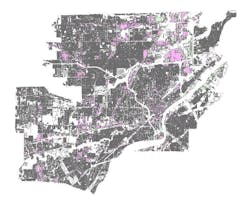
The city of Toledo, Ohio, needed to update its storm water utility. Toledo prioritized updating and maintaining an accurate and equitable GIS dataset for use in levying storm water bills. Impervious surface mapping enables cities like Toledo to update its equivalent residential unit database and determine how much to charge customers for its storm water utility.
This was a two-phase program: the first phase entailed a mapping component, which is complete; and the second phase is a billing integration (SAP billing system), which will take nine to 10 months. The second phase will correct links and design web interfaces so the public can see how each property was assessed. For the mapping portion, Woolpert worked with the department of engineering services in Toledo, and within the second phase, Woolpert is working with Toledo’s billing department.
Buildings, tree canopies and shadows presented a challenge, as these elements obscured some hard surfaces, preventing accurate mapping. Another large challenge was that prior to the project, Toledo had inconsistencies in its processes, including broken links within the billing system. Machine learning was used to achieve the desired accuracy and schedule. Machine learning processes rely on a 4-band orthoimagery with 3-inch resolution and aerial lidar with a density of 2 points/square meter.
“I feel very good about the overall result,” said Woolpert Vice President Brian Stevens. “The client has a dataset that can not only help manage storm water runoff but can understand how water is flowing through the community to identify flooding issues and provide solutions.”
The project is in Phase 2 and expected to wrap up early 2022.
