About the author: David Brown is chief hydrologist for USGS Gulf Coast. Brown can be reached at [email protected].
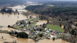
Early this summer, Texas witnessed historic rainfall, which led to record-setting flood levels. David Brown, U.S. Geological Survey (USGS) Gulf Coast program office chief and chief hydrologist, talked to SWS Associate Editor Bob Crossen about stream gage installation and implementation during the Texas flood.
Bob Crossen: How severe is the flooding situation in Texas, and where is flooding at its worst?
David Brown: Preliminary measurements show record flooding occurred on several tributaries to the San Jacinto River, including Spring Creek, Cypress Creek and Willow Creek. USGS crews measured high flood flows and verified stream gage operations in the Houston region on the Brays Bayou, Sims Bayou, Greens Bayou, White Oak Bayou, Cypress Creek and Spring Creek streams. Flooding lasted several weeks in central Texas as the floodwaters traveled downstream on the Colorado and Brazos river basins.
Crossen: What conditions led to the flood levels seen in Texas?
Brown: Significant rainfall occurred at various locations in Texas the past few months. The National Weather Service reported that more than 10 to 16 in. of rain fell in one day, causing homes and roadways to flood in parts of southeast Texas. In March, more than 20 in. of rainfall occurred over a few days in several locations, including the Toledo Bend Reservoir area (east Texas) and in the Houston region.
Crossen: What has USGS done to aid local officials during the flood?
Brown: USGS crews track the movement of the floodwaters as rains continue and the water moves downstream. This information is critical for resource managers and emergency responders to develop flood forecasts and help protect life and property. During recent flooding, USGS coordinated efforts with the U.S. Army Corps of Engineers, National Weather Service, Harris County Flood Control District, San Jacinto River Authority and other local and state partners.
Crossen: In what ways has flood stage monitoring helped residents?
Brown: There are more than 550 USGS-operated stream gages in Texas that measure water levels, streamflow and rainfall. Real-time flood information assists officials in issuing flood warnings and evacuations. Monitoring data can also help verify the magnitude of a flood that occurred, and can assist with predicting the effects of potential future floods.
Crossen: What does USGS do with the monitoring data and how can people view that information?
Brown: A link for USGS monitoring data in Texas can be found online on the USGS Texas Water Dashboard website. People can view more than 750 USGS real-time stream, lake, reservoir, precipitation and groundwater stations in context with current weather and hazard conditions. Two Twitter feeds—@USGS_TexasFlood and @USGS_TexasRain—distribute water level and precipitation data during flooding or severe rainfall.
Download: Here


