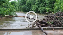
Empowering Drainageway Assessments in the Denver Metro Area
Understanding how and where water moves throughout urban, suburban and rural landscapes is critical for managing healthy waterways and reducing flood risk. Maps are an integral tool used in the storm water management process. These maps however often are out of date and lack the detail needed to provide the necessary data for making decisions about how and where to leverage resources for upgrades and repairs to infrastructure or how to mitigate for flood control. Municipal and county drainageway systems can be vast covering hundreds of miles and are often difficult to access making site visits by engineers and technicians expensive, time consuming and inconvenient. Modern mobile mapping technology using ground-level 360-degree panoramic imagery in concert with Esri ArcGIS Online maps makes assessment from a desktop computer possible, reducing the need for field visits and decreasing assessment costs.
EarthViews began using mobile mapping technology in 2016 to help connect people to critically important aquatic and terrestrial ecosystems. EarthViews works with NGOs, Federal, State and Local resource managers to help achieve this mission. To accomplish their vision, EarthViews developed technology to bring waterways to desktop, mobile or VR devices via easy-to-use, publicly available, interactive maps of 360- degree panoramic imagery and data. These reality-based maps have many uses for waterway conservationists and natural resource managers, including:
- Digitally preserve the waterway, creating a historical baseline of conditions
- Visualize waterway data in context
- Collect data
- Locate points of interest
- Educate with virtual field trips
- Scope areas for recreation activities; and
- See it before you get there to enhance waterway emergency management and navigation.
City of Westminster Drainageway Assessment
The following case study describes how the city of Westminster near Denver, Colorado, and the environmental consulting firm Enginuity Engineering Solutions leveraged EarthViews technology (like street view for storm water management), for the city’s drainageway assessment.
Establishing an existing baseline condition along drainageways is often a costly, time-consuming and overwhelming task for local municipalities. Master plans typically serve as the guiding resource for managing drainageways and storm water infrastructure, but many planning studies are outdated and don’t reflect actual conditions. Often, master plans can leave local managers with more questions than answers when determining maintenance and capital improvement needs throughout a community.
Rapid Baseline Stream Assessments
EarthViews partnered with Enginuity Engineering Solutions, LLC to complete project goals which included:
- Scan with surface-level 360-degree imagery, map and evaluate the existing conditions along 68 miles of streams drainageway storm water systems;
- Scan with surface-level 360-degree imagery, inventory and inspect all in-line infrastructure and local detention basins;
- Create a geodatabase capturing all data collected in the field for city use and management;
- Evaluate and recommend maintenance and capital improvements system wide and;
- Prioritize and cost capital improvement projects and regular drainageway and stream maintenance.
Field Methods
To create a locationally aware virtual database of drainageway conditions EarthViews supplied Enginuity with a turnkey image and location data collection system. Worn on the back, this mobile image mapping system was synchronized with basin and infrastructure condition information collected in the field by technicians.
Survey methods incorporated a consistent data collection template and utilized technical criteria that was consistent with local jurisdiction requirements.
Project Results
The project goals were to catalog the existing conditions along all the drainageways within Westminster in order to prioritize capital improvement projects over the next 10 years. Leveraging the collected data on hazards, infrastructure quality and overall stream health allowed for a more comprehensive examination of the ecosystems in which the valuable metrics can be determined by different users.
These online maps of imagery and data allow for a diverse working group to acquire a foundational understanding of each stream’s current condition, problems and overall health. This analysis method removed the reliance on just the consultant’s judgment to prioritize outcomes. The ability to wander the drainageways from your desktop computer gave a diverse group of city staff the ability to see the system and its overall conditions for themselves.
Mapping Survey Results
68 miles of drainageway rapid assessments including imagery and evaluations for:
- 191 stream visual health assessments
- 105 storm control facilities
- 275 grade control structures
- 441 drainage outfalls
- 290 erosion hazards
- 276 stream crossings
- Development of $32 million of recommended maintenance and capital improvements
- Prioritization of 95 individual reaches for capital improvement projects and maintenance projects based on existing conditions and;
- Recommendations, prioritization and costing for 49 “nuisance flooding” issues throughout the city.
Infrastructure
In total, this effort recommended over $10 million of improvements for all tributary reaches within the city of Westminster and over $22 million for improvements along Big Dry Creek to mitigate existing erosional hazards, damaged infrastructure and flooding hazards.
Conclusions
Born out of the scale of the data collection effort and the desire to create a geodatabase template that could be used by city staff, the rapid baseline assessment criteria allowed for a consistent data collection effort that quickly captured the data necessary to assess the drainageway and storm water infrastructures condition and function.
Quantitative published criteria were used from the NRCS (stream visual assessment protocol (SVAP)), FHWA (culvert assessment and decision-making procedure), and Rosgen (applied river morphology) in the hopes of creating a comparable dataset, not just within this study, but for the wider community now and into the future.
Determining where to allocate resources on maintenance and capital projects used to be a hidden and exclusive practice. The engineer takes their own impressions of the system, applies weights and qualitative scores for different categories and provides a solution to city managers. This method creates a transparent process that is available to all city staff and the public by creating a large, consistent, contextualized online database, allowing anyone to leverage the data to make informed decisions.
About the Author
Brian Footen
Brian Footen is the president and co-founder of EarthViews.


