Sullivan's Island resilience plan pairs gray infrastructure with green solutions for 2050
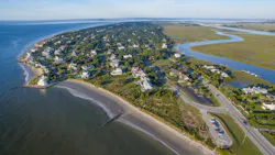
South Carolina's barrier island system represents perhaps the most dynamic landform of the southeastern region of the United States, with wind, waves, and currents constantly reshaping these narrow deposits of sand running parallel to the coast. Positioned at the edge of land and sea, these islands are particularly vulnerable to the effects of climate change and face mounting pressures from rising sea levels, development pressures, and more frequent and intense storms. Recognizing these risks, in 2024, the Town of Sullivan's Island created the Sullivan's Island Sea Level Adaptation & Resilience Plan. This followed their recently published Island-Wide Stormwater Master Plan and Infrastructure Improvement Strategy Report. In developing these two plans, the town recognized the value of creating a resilient strategy that integrates gray stormwater infrastructure improvements and green nature-based solutions.
The town's resilience plan proposed a variety of nature-based solutions that complement traditional drainage infrastructure, providing opportunities for water to infiltrate into the ground or storing water for a delayed release. These techniques function to decrease the volume of stormwater runoff making its way into the town's centralized drainage system while providing a host of co-benefits, ranging from water quality improvement to biodiversity support.
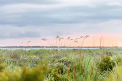
Taking the brunt of Atlantic storms
Sullivan's Island is located at the entrance of Charleston Harbor, boasting almost four miles of ocean-front shoreline and around 600 acres of tidal salt marshes along the landward ("back beach") side. As such, the island is no stranger to the power that natural systems can provide in defending against hazards. In 1989, a Category 4 Hurricane Hugo hit the adjacent city of Charleston, placing the more powerful north side of the eyewall directly over Sullivan's Island. The destructive impacts of Hugo ultimately led the town to prioritize protecting the natural habitats that act as buffers, including sand dunes, maritime forest, and salt marsh.
Today, the island is more resilient than ever, as a protected 200-acre maritime forest combined with an overall robust beach and dune system serves as an important natural defense system against the impacts of high wind and waves brought by offshore storms. However, the island still remains vulnerable to the effects of rainfall and tidal flood events, given its low elevation and gravity-dependent drainage infrastructure. This type of flooding represents a regular nuisance with some properties inaccessible for days at a time after rain, as well as a public safety concern during major storm events.
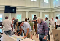
Community engagement as a foundation for improved resilience
One of the distinguishing features of the town's resilience plan is the emphasis on community participation to co-create a roadmap for resilience. The plan was developed through a series of stakeholder interviews, public engagement sessions, a community survey, and presentations to decision-makers. These open and transparent touchpoints with the community helped to provide an understanding of existing conditions, validate model results, and allow for consensus building on proposed solutions to better address the unique concerns of the community. Residents, business owners, and public officials alike had the opportunity to provide input on the impacts they have experienced, like tidal flooding on roadways, adaptation strategies necessary for businesses and utilities, and flooding in residential spaces. Community feedback played a critical role in the development of the plan to ensure that both technical analysis and first-hand accounts of lived experience were included.
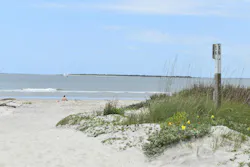
Modeling sea level rise and compound flooding
The resilience plan looked ahead 25 years to align with the typical lifespan of many stormwater infrastructure improvements and nature-based solutions. In 2050, the sea level around Sullivan's Island is projected to rise by 1.07 feet when accounting for both regional projections and vertical land motion. This means that a typical high tide could reach about 4.38 feet NAVD88, potentially producing routine "sunny-day flooding" in low-lying streets and yards even without precipitation. To model current and future conditions across the island, the existing hydrologic and hydraulic model was modified. The model had originally been developed using PCSWMM during the formation of the island's stormwater plan. The modified model represents the hydrologic and hydraulic functions of the island's natural systems in combination with stormwater infrastructure by incorporating additional watersheds for the beach and marsh regions. The project team — Weston & Sampson, Elko Coastal Consulting, McCormick Taylor — analyzed several modeling simulations to represent multiple rainfall scenarios, including the worst-case scenario of a 100-year rainfall event in 2050. Results from the various modeling scenarios identified locations where rainfall, tides, and storm surge could combine and produce extensive flooding across the breadth of the island. This hydrologic and hydraulic analysis helped identify vulnerable locations where nature-based solutions could potentially be implemented to address the inundated areas.
The resilience and stormwater plans were developed in tandem through a shared hydrologic and hydraulic model. This allowed for modeling future conditions to represent flood reductions resulting from both proposed improvements to the stormwater infrastructure and the incorporation of nature-based solutions.
Nature-based solution strategies
The resulting 10 adaptation strategies that were proposed because of community feedback are diverse in nature, ranging from island-wide policy recommendations to natural system restoration. All the strategies incorporate nature-based solutions for both residents and community applications, finely tuned to the unique constraints of barrier island hydrology to maximize benefits. The strategies are intended to provide a playbook of solutions for consideration by decision-makers and community members when adapting to ongoing and future coastal challenges.
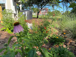
The proposed strategies take advantage of natural processes to manage runoff, improve water quality, and reduce flood risk while also providing co-benefits to the community, including urban heat mitigation, habitat enhancements, and beautification. Examples of the nature-based solutions identified for Sullivan's Island include:
- Bioretention systems and rain gardens to capture and infiltrate stormwater runoff
- Bioswales along public rights-of-way to slow and filter water
- Permeable pavement systems that reduce impervious surface runoff and provide water treatment
- Green roofs and rainwater harvesting systems for increasing water storage capacity on both residential and commercial scales
- Constructed wetlands that provide both water storage, water quality benefits, and wildlife habitat
Recommendations also recognized the importance of preserving and enhancing the island's existing natural defenses like salt marshes, maritime forests, and dune systems, which play a critical role in protecting the island. Recommendations for managing these resources include marsh restoration, dune stabilization, removal of invasive plant species, and expanding urban tree canopy coverage.
Building resilience through integrated strategies
With visionary leadership and a commitment to safeguarding both its environment and way of life, the town has embraced a proactive approach to resilience. The Sea Level Adaptation & Resilience Plan is not merely a response to threats; it is a bold blueprint for action, designed to ensure that Sullivan's Island continues to thrive for generations to come. By integrating science, community engagement, and innovative strategies, the island sets a new standard for coastal resilience, demonstrating that with foresight and determination, even the most vulnerable communities can secure a vibrant, sustainable future.
About the Author
 Kim Morganello
Kim Morganello
Kim Morganello is a Climate Resiliency Designer with Weston & Sampson in their North Charleston office. She specializes in collaborative development of innovative approaches to achieve resiliency with a focus on community engagement, placemaking, natural resource stewardship, and water resource management for current and future conditions. She can be reached at [email protected].
 Katie Finegan
Katie Finegan
Katie Finegan, PE, is a Project Manager in Weston & Sampson’s Conway, South Carolina office. She specializes in coastal and environmental engineering with an expertise in shoreline restoration, stormwater modeling, and coastal resiliency planning. She can be reached at [email protected].
 Rebecca Fanning
Rebecca Fanning
Rebecca Fanning is the Director of Resilience & Natural Resource Management for the Town of Sullivan’s Island. She received a master’s degrees in environmental science and public administration from the College of Charleston, where her research focused on the interaction between degraded stream morphology and effects on riparian plant communities. She can be reached at [email protected].
 Lucas Hernandez
Lucas Hernandez
Lucas Hernandez is a Senior Project Scientist in Weston & Sampson’s North Charleston office. His expertise includes resilience planning, hydraulic & hydrologic modeling, geospatial analysis, sustainable and resilient design, community engagement, and green infrastructure and nature-based solutions. He can be reached at [email protected].