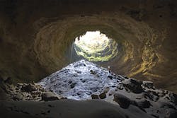
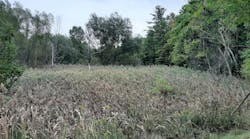
The world underground is more complex and far more interesting than most people give it credit for, if they think about it at all. Those of us who deal with erosion and sediment control are in a better position than most to appreciate it, perhaps having studied soil types, read through dozens of geotechnical reports, and actually dug into terra firma. We can picture soil strata or, in the built environment, the layers of utilities, sewers, and water lines that must be avoided during excavation.
But there are unexpected things down there, too. A few weeks ago, the underground realm was brought starkly to the public’s attention when a sinkhole in Florida claimed part of a house and one of its occupants. Tragic as the incident was, it highlighted the fact that sinkholes, also called dolines, are not all that unusual in some parts of the country.
In Florida and other regions of the Southeast, sinkholes are caused by water dissolving limestone. (They can also have other causes, such as leaking water lines.) As the bedrock dissolves, the so-called karst topography can result in shallow depressions, ranging from only a few feet to thousands of feet wide, which are often seen as ponds or marshes from aboveground. Occasionally they collapse; by one estimate, insurance companies in Florida alone receive an average of 17 claims per day for sinkhole-related damage, for a total of about $1.4 billion over a five-year period.
Several years ago, Stormwater magazine published a detailed article on karst landscapes, including the implications for water quality, focusing particularly on Greenbrier Valley in West Virginia. (The article, “The Secret World of Greenbrier Valley: Agricultural Runoff and Water Quality” by Robert R. Bowers, appeared in the November/December 2001 issue and is available online at http://www.stormh2o.com/SW/Articles/3358.aspx.)
Karst soils tend to be rich in nutrients and ideal for farming. As Bowers points out, while karst terrain makes up only about 20% of the Appalachian region, more than a third of its farms and cattle are located within that 20%. And because the funnel-shaped dolines naturally collect runoff-much of it containing crop fertilizers, pesticides, and cattle manure-the effects on the region’s groundwater are of concern.
The author, accompanied by two specialists from the USDA Agricultural Research Service who were studying local groundwater quality, went down into the caves within the limestone, crawling through tight spaces and wading in waist-deep water as far as 500 feet below the surface. The USDA researchers regularly collected and analyzed water samples to determine how farming activities might be affecting the water, then helped develop BMPs to counter the effects of those activities.
His photos alone are worth taking a look at the article, from the underground limestone formations to the creatures-salamanders, bats, insects-that live there. It’s a reminder of something we don’t often see, or even think about, that’s intimately connected with what we do aboveground.About the Author
Janice Kaspersen
Janice Kaspersen is the former editor of Erosion Control and Stormwater magazines.


