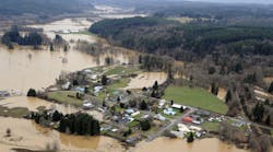
FloodMap App Provides Flood Risk Information
Atkins' first-ever app for evaluating flood risk, FloodMap Mobile, is now available free of charge to anyone via the Apple App Store, the Android app store and the Windows Phone Store.
To help communicate flood risk and help citizens take mitigation action, the Atkins FloodMap Mobile smartphone app is a comprehensive tool for users to understand their personal risk exposure and how to get help.
The app provides flood risk information on demand based on the user’s location or entered address. It also offers an individual risk report customized for that address, which can be emailed and shared.
“FloodMap Mobile places critical decision-making information into the hands of those with the power to make changes—you and me,” said Atkins senior project manager Josh Price, GISP, CFM. “We’re proud to now offer this useful app to the public at no cost.”
FloodMap Mobile gives floodplain managers, city planners and emergency responders on-demand access to critical information in the field. Using the mobile app, engineers, community officials and customer service authorities have access to information about map numbers, quads, gages and floodplains. FloodMap Mobile is also a tool for both real estate professionals and prospective home buyers to understand flood risk for specific properties, including an estimated flood-insurance cost based on home value.
With more than 4,000 downloads to date, FloodMap Mobile is now available for free via the Apple App Store for the iPhone, iPad, and iPod touch. It can also be downloaded via the Android Market app or the Android app store for Android-based tablets and smartphones, and via the Windows Phone Store for Windows Phone.
Source: Atkins


