Ensconced in the scenic Shenandoah Valley, the city of Staunton, VA, with a population of around 50,000, had all the attributes of a grand historic town poised for greatness. As a tourist attraction, the city boasts easy access to famous Civil War battlefields, rustic countryside, and the childhood home of President Woodrow Wilson. Many consider it a nice place to live, with its classic historic architecture, quaint main streets, and growing popularity. Sharon Angle, Staunton’s director of planning, says that in addition the town, in keeping with the Virginia Department of Environmental Quality’s commitments to help clean the Chesapeake Bay and its own clean water ethic, “has been working diligently to improve water quality for over two decades.” Among other water-quality initiatives, the town has implemented tree-planting projects, engaged in efforts to build green infrastructure, and deployed permeable parking facilities and other multifunction amenities geared toward improving the quality of water flowing into tributaries to the Chesapeake.
But something was missing, and it had been for a long time. Although it was not readily apparent to the casual observer, about 300 feet of Peyton Creek, which once ran through town, had been banished to an underground vault. The creek had been buried about 100 years ago to make way for a playing field for a local high school. The site was later taken up for other uses, including a permeable parking area for the town’s community theater.
Thinking of the growing importance of water quality and opportunities to improve the amenities Staunton could offer, Angle and other residents began to consider bringing Peyton Creek back to the surface to perform its ecosystem functions while enhancing the aesthetics of the town. In pursuit of this vision, Staunton applied for a number of stream restoration grants and, with $209,000 awarded by an EPA and American Rivers grant, began exploring the option of daylighting the creek.
Breaking the Surface
Sidling up to the Mississippi River, Dubuque, IA, had been experiencing wave after wave of flooding disasters, culminating in catastrophic flooding during storm events of the late 1990s and six national disaster declarations since that time. Periodic flooding for many Dubuque residents could not be considered an isolated occurrence. With relatively flat elevations in the local area and abundant water, flooded basements and inundated road surfaces spreading out along a mile-long stretch of the city had been long accepted as a fact of life in the North End and Washington Street neighborhoods.
When Deron Muehring came to work for the city of Dubuque as an engineer 17 years ago, he began hearing complaints about the “storm sewer” that ran through this section of the community subject to repeated flooding. As he began to familiarize himself with the engineering concerns the residents had voiced, he became intrigued by discussions of a large-scale storm infrastructure that he understood, from conversations with the locals, had been designated B-Branch of an engineered stormwater conveyance system. He surmised the sewer system’s B-Branch was a problem of inadequate infrastructure that needed to be fixed. He had the pronunciation right, but not the spelling.
He soon learned the problematic sewer was technically not a sewer at all; it was a creek, and its name was not derived from the drawing boards of efficient civil engineers. The Bee Branch, as he learned from US Geological Survey reports, took its name from its historic connection to Bee Lake on the rural outskirts of the city. It was formerly a rustic natural hydrologic feature called Bee Creek. Most people had no idea there was a creek flowing through the neighborhood, because it had been buried and all but forgotten more than a century before Muehring took up his position at the city engineering department.
Bee Branch had been the source of near-constant irritation to homeowners who, for the most part, had no idea of its former status as a natural free-flowing surface stream 100 years prior. According to Muehring, in 1889 and 1890 Dubuque made the decision to start putting the creek into a culvert, and in 1898 the city council began taking action to bury the creek. But in 1999, Bee Creek sent a clear message that it wanted out.
With considerable fanfare provided by Mother Nature in the form of thundering cloudbursts, tornado warnings, and heavy rain of an epic 1999 storm event, the creek overwhelmed the “storm sewer system” and backed up to overflowing around entrances to culverts. Inconveniently, in the midst of that storm—minus the customary groundbreaking ceremonies attended by city leaders and water-quality advocates—”The creek daylighted itself,” says Muehring.
If neighbors had wondered why their basements were habitually damp or occasionally flooded to the rafters, Muehring says, that event clarified things quite a bit. City officials decided definitively that something had to change. A century after the creek had been encased in a stormwater conveyance, it became abundantly clear the original intent of containing the rains in a simple tunnel could not be met satisfactorily within the existing infrastructure.
A Movement Takes Shape
In American River’s report on stream daylighting efforts around the country, Amy Trice writes that in addition to innovative practices for stormwater control such as bioretention, rain gardens, and green roofs, stream daylighting in some instances can prove a more economically and environmentally effective option for reducing risks of flooding and improving water quality. Further, according to Trice, raising awareness of buried streams in urban environments can benefit communities by helping “generate an interest in clean water, community health, and revitalization.”
With help from its American Rivers grant, Staunton, VA, began its proposed mission of excavating the long-buried Peyton Creek. The first order of business was figuring out exactly where the creek was located, not an easy task considering it was buried more than a century earlier in an era predating precise geodetic records. Concurrent with mapping the creek, and of equal or greater importance, was gauging the community’s sentiments about embarking a project as monumental as unearthing a nearly forgotten waterway in a much-used area of the town.
“There were mixed feelings,” says Angle. The creek was located under the parking lot of the popular community theater, considered by many a good a good cause in itself; it became difficult to decide which was the greater good. However, the idea of an attractive daylighted stream in place of convenient parking eventually caught on with the community.
Wet and Wild History
Experts say the natural history of America’s urban streams stretches back thousands of years, at least to the Ice Age when much of North America, creased scoured by glacial advances and retreats, received its most recent natural makeover. During the era of urbanization and industrialization, however, in many areas of the US nature ceased playing the dominant role in sculpting the cuts and contours of the land. Human hands performed the role of make-up artist from the 17th century onward, and the results, while utilitarian, have not always been stunning. In the most desirable stretches of land, which became the cities attracting thousands of people as permanent residents, meandering creeks were considered detrimental to progress, property, and well-being. The natural history of streams gave way to engineered conveyances, and many natural waterways were graded, filled in, or channeled and controlled, both on the surface and underground, directing untreated stormwater to rush into rivers and promoting flash flooding wherever the volume of rain exceeded design capacity.
American Rivers cites Baltimore, MD, as typical of the way surface streams have been manhandled in the United States’ most prominent urban settings. A recent paper by Andrew Elmore and Sujay Kaushal of the University of Maryland documents that, similarly to many urban areas built up between the Colonial era until the very recent past, nearly 73% of Baltimore’s natural low-order waterways had been erased by the early 1900s, with a host of detrimental environmental effects; most remain buried to this day.
During the disasters of the 1990s, Dubuque’s Bee Creek threatened homes with electrical fires, mold, and other damages as the waters rose to inundate household furnaces, electrical boxes, and personal property. Residents coped with the inconvenience and health hazards caused by moisture seeping into consistently damp or flooded basements. Eventually, the city sought aid from Clean Water State Revolving Fund (SRF) to address the issue.
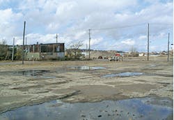
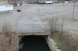
Lower Bee Branch area before work began
Come High Water
Audrey Morey was one of the victims of the 1999 Bee Creek floods. She recalls “flowing water covering the street” in front of her property as it encroached toward the doorstep of her house. Barricading the door would have made little difference; the creek had already found another way into the home. “The sump pump could not keep up. I had 36 inches of water in the basement. We lost the water heater, the furnace, the sump pump, and just lots of personal items.” Hers was just one of more than 1,500 homes that suffered, or were at risk of, significant damage during such flooding events that resulted, by 2011, in six presidential Disaster Declarations and an estimated $70 million in damages.
Shortly after the 1999 flood, Morey decided to became a very active member of the community, working to resolve the issues with Bee Branch. She joined the Bee Branch project’s citizens advisory committee in 2002 as one of its original 16 members. She says that from the beginning, “the conversation was what could we do for Bee Branch.”
The city’s engineering analysis indicated that to adequately contain Bee Branch within its underground conveyance system, the storm sewer, already 12 feet in diameter, would need to be expanded to five times its existing capacity. While something needed to be done, Muehring says, the potential for disruption to the community during construction of such a mammoth project, as well as its expense, strongly disfavored the expanded storm sewer concept. Instead, following the recommendations arising from the citizens advisory committee, the city began exploring the option of daylighting the creek and restoring a more naturalistic drainage pattern to the basin.
When the city went to the public with the idea of reintroducing Bee Creek as a surface waterway, says Muehring, “A lot of people were unsure about the proposal.” Some held the attitude of “out of sight, out of mind”; others envisioned an unsightly concrete gully “kind of like the image people have of the Los Angeles River. It took a while to let people know what it would look and feel like.”
Lower Bee Branch area before work began
A lifelong resident of the 6.5-square-mile Bee Branch watershed, Morey says, “The major challenge during the process was getting citizens onboard with the idea of open water running through our neighborhood.”
She adds, “We felt we needed something that would impact relief. As a citizen, I felt we had to realistically look at getting something done. We looked at costs; we factored in a lot of things. There were conversations about safety—the problem of standing water, the problem of insects.” According to Morey, as the citizens advisory committee got more deeply involved in the design discussions, the city presented photos and examples of successful stream daylighting projects that had been implemented around the world to demonstrate what was possible.
“We were skeptical at first, but we had to have faith that this would happen in the way it was projected,” says Morey. She notes that the city helped by being very responsive in allaying the community’s concerns one by one, gradually converting fears into optimism about the project’s potential. For example, she says, concerns residents had over the potential for standing water were quickly evaporated when engineers from the city presented the committee with the projected slope factors for the proposed creek from survey data on the basin.
Ultimately, the project got the buy-in and active support of the community to proceed in two phases, says Morey. Work on the Lower Bee Branch daylighting project, begun in the fall of 2010 and was completed in late fall of 2011. It was followed by daylighting activities on a reach known as the Upper Bee Branch, now under construction and slated for completion in 2017.
Muehring credits the citizens advisory committee as essential to the success of the project, both as a liaison to the affected communities and as a resource of ideas and inspiration.
Morey’s positive impressions of the project took a more concrete form (or rather, a less concrete form) in 2011 when the cement encasement of the Lower Bee Branch was finally broken up to be used as backfill, releasing the stream from its century-long interment, and the first phase of the project reached completion. “I felt comfortable that we made a good decision. The city kept its word about what they were going to do to make it neighborhood friendly.”
According to Muehring, one of the keys to the community’s acceptance of the proposal was the city’s commitment to maintain connections between various parts of the neighborhood by building in new bridges and pathways to enhance connectivity within the community and to the creek itself within the overall plan. In addition, he says, planners worked hard to minimize disruptions to the neighbors’ routines during construction through web-based updates and by resolving all unavoidable street closures as quickly as possible. “The alignment was based on the work of the citizens advisory committee to maintain services and not remove, for example, the only grocery store in the area,” says Muehring.
As a bonus, aside from its aesthetic merits, Morey believes the restored creek has probably already delivered positive economic effects for property owners in the neighborhood. “I would certainly think it will improve the value of homes for the residents who are still here for the logical reason that you’re going to purchase and know that the flooding issue is being dealt with, and you don’t have that worry. And the landscape is quite attractive.”
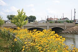
Lower Bee Branch after daylighting was completed
According to Strand Associates, the Madison, WI-based engineering consulting firm that oversaw the design of the Bee Branch project, the goal, after updating the hydrologic and hydraulic models, was to designate a naturalized channel configuration and riparian area to integrate the stream with a variety of adjacent land uses.
The overall project costs total $59 million funded using a combination of general obligation bonds; Iowa Disaster Relief funds; SRF; city of Dubuque stormwater utility fees; Federal Highway Administration funds; and contributions from local businesses, organizations, and citizens. Additionally, a $2.25 million River Enhancement Community Attraction and Tourism (RECAT) grant from the state was awarded for amenities associated with the Bee Branch Creek restoration project, and a state $3.9 million I-JOBS II grant was awarded for the Lower Bee Branch Creek restoration based on the disaster prevention measures associated with the project.
Regarding Iowa’s Clean Water SRF, Muehring says, “It took a while for the state agency to accept the fact that daylighting a creek was an appropriate way to spend water-quality funds.”
However, the agency was eventually persuaded, and a loan of up to $4.4 million loan was approved for the Upper Bee Branch Creek restoration project through the SRF/EPA Green Project program based on the environmental benefits of daylighting the Bee Branch Creek.
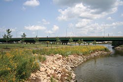
Key elements of the project include more than 400,000 cubic yards of excavation to create 4,500 linear feet of open channel waterway and dredging of a 25-acre detention basin. The majority of this material was used to fill an adjacent surplus detention area, thus creating a 6-acre redevelopment parcel and contributing to a $7.5 million reduction in project costs. Structural elements include a trenchless crossing of the CPR Railroad switching yard and four vehicle bridges.
Rendering of Rhomberg Bridge
The new open channel accommodates a spring-fed base flow that will be capable of supporting a healthy stream ecosystem. To preserve the health of this system, a number of sustainable water-quality improvements were incorporated, including the installation of 2,500 linear feet of pervious roadway, 50 pervious parking stalls, four hydrodynamic stormwater separators, five bioinfiltration basins, cascade aeration features, and reuse of noncontact cooling water for irrigation source water. To preserve the history of the Bee Branch Channel, portions of the existing stone storm sewer were salvaged and reused to construct channel bank areas and other adjacent features.
The channel corridor provides linear community space that encompasses an extension of the regional Heritage Trail, a pedestrian bridge, educational kiosks, overlooks, an amphitheater, an orchard, benches, lighting, and 1,000 new trees. Muehring says the creek bed comprises naturally occurring rock formation augmented where needed with locally quarried limestone. In addition to the trees planted as part of the plan, the adjoining flood plain and creek buffers will be landscaped with low-mow fescue and prairie grasses to minimize maintenance costs.
Morey especially likes the idea of the community orchards, walking paths, and amphitheater planned for the site. “To me it was really important that they had a combination of having it very functional and having it look nice for the people of the area—they deserve that—and they did that, and it’s given me a lot of optimism for the Upper Bee Branch project that is now underway.”
So Nice They Did It Twice
Along the Hudson River, just north of the city that’s named twice, stands a town that has recently completed a project that elicits a concrete measure of civic pride—by removing the concrete.
Ann-Marie Mitroff, then executive director of Groundworks Yonkers and now with Groundwork Hudson Valley, says daylighting efforts in her hometown of Yonkers, NY, pioneered by her organization and completed in 2011, have resulted in a newly revived Saw Mill River. She said the project “worked out so brilliantly” that the city has since moved ahead to daylight an additional 120-foot stretch of the urban river. Mitroff believes, in fact, that the river restoration projects have “changed the economic direction of Yonkers,” revitalizing interest in downtown development.
According to Mitroff, daylighting projects not only beautify but also can resolve flooding issues and improve water quality by increasing opportunities for pervious surfaces and other improvements. “We found we can address water-quality issues; as we are going in and unearthing things, other things get fixed at the same time.” For instance, she says all the sewers dumping sewage into daylighted sections of the Sawmill River were disconnected as the project moved down the stream. Along the city’s second phase of the project, called the Mill Street section, “We found and fixed all sewer pipes that had been coming from buildings dating back to the 1800s.” She says every one of the undocumented, unmapped, and unregulated connections within the vintage structures on the path of the daylighted project “were found and cut off from dumping sewage into the river.”
In addition to cutting off the legacy sewage flows from older structures along the river, the second phase of the Sawmill daylighting project at Mill Street, which is slated for completion this year, will feature a bioswale and pedestrian bridges overlooking the downtown creek to allow foot traffic access to the intriguing views of the newly cleaned up river below the city.
Mitroff also sees daylighting as “a powerful tool for building resilience,” one that she says should be included among other measures to deal with predicted changes in climate. These changes include an increasing probability of heavy rains and storm surges, such as those experienced on the Hudson River during Hurricane Sandy.
As a result of the Saw Mill River daylighting projects, “The city is looking at a whole new way of thinking. It has changed the discussion in the city in a real way,” she says. The newly visible river “promotes more of a real-time discussion. Once things start to be talked about, it helps managers, staff, and city leaders, who are often caught up in the day-to-day grind of pothole work, pipe repairs, and sewer leaks, to focus as well on broader long-term goals as well.
“This has brought a whole new level of understanding among managers, council leaders, and legislative bodies of the city. I think it’s been really helpful.”
Core Realities
As coring samples taken in Staunton, VA, staked the outlines of the buried sections of Peyton Creek, the engineering surveys and brownfields studies began to paint a disappointing picture. Coming into the project, “the city had done all the right things,” says Sharon Angle. “It had garnered community support for the daylighting concept, and with an innovative site plan, it had competed for and obtained a financial commitment of support through a competitive grant from American Rivers.”
However, due to circumstances that could not have been predicted, a cloud nonetheless loomed over the proposed daylighting project. According to Angle, it wasn’t until the coring surveys delved down to a depth of 12 feet that they reached the roof of the vault enshrouding the creek the city had hoped to uncover. Angle imagined the creek flow would be several feet further down below that 12-foot depth. Daylighting a creek buried so deeply would require a drastic reworking of the city’s plan.
“Peyton Creek had been buried much deeper than anybody originally thought, and therefore the excavation costs we had estimated when we put the grant in were totally wrong,” she says. “We could not get any more money to do the project, and it turned out to be more complicated than anybody thought.”
Although the city of Staunton owned the land directly above the buried stream, Angle concedes that in order to deal with the stream in the way the American Rivers grant program required—using natural stream beds and expansive buffers—a great deal of additional space would be required.
Although building a wall to contain the stream might have allowed the city to pursue the daylighting objective of the project, that option would have required nearly $250,000 dollars more in funding than the city had access to. In an additional complication, Angle says, the American Rivers grant “specifically ruled out retaining walls in favor of soft treatments, which would require more land.” With neighboring owners unwilling to donate land to the project, and no other sources available for funding the construction of a wall to constrain an unearthed creek 12 feet or more below grade, Staunton was forced to abandon the project and forego the funding it had been offered. Facing the sobering reality, Angle concedes, “In urban cases, sometimes you just need a wall.”
Angle was disappointed but not disheartened by the results of the city’s exploration of the daylighting concept. She says the studies that American Rivers funded, which pinpointed the location of the creek, will continue to have value, and will be especially useful if circumstances change and the option of unearthing the stream arises at some future date. In the meantime, Staunton’s garden club erected a marker to accurately reflect the location of the city’s still-buried treasure.
A Dream Realized
With thousands of miles of buried streams coursing through virtually every major and medium-sized city in the country, Kent Loci, director of business development for Strand and Associates, says there is “a growing excitement” about opportunities for stream daylighting projects.
He believes, however, that “enthusiasm varies depending on each municipalities’ situation. Some places like Dubuque see it as green infrastructure, while others see it as an expense. We see a range of thoughts on it as a water-quality measure.” But he adds, “As people come to recognize the importance of water, they will continue to look for improvements.”
He notes, “Some of these corridors have a lot of opportunities for a range of improvements and for secondary improvements beyond the stormwater management, and then there are other corridors that you can daylight the stormwater, but there may not be a lot of other opportunity there, due to the constraints or due to the overall hydraulics.”
Loci recommends that communities considering daylighting projects “start with a study phase to evaluate what the opportunity is,” just as Staunton, Dubuque, and Yonkers did. “It’s really a matter of weighing the opportunities and the impacts.”
Partly as a result of its Saw Mill River daylighting projects, Mitroff says, Yonkers has recently joined an exclusive club of 17 municipalities being designated by the US Fish and Wildlife Service as urban wildlife refuges. This allows the city to participate in a number of innovative programs offered through the FWS to open opportunities for young people of all ages in the community to strengthen their connections with nature. “Who would have thought a few years ago, with the concrete in that plaza, that we’d now have a partnership with the Fish and Wildlife Service helping to show that wildlife is not just something for the Rocky Mountains and out West, but that we have wildlife right here in our cities.”
Although she hasn’t seen them in person, Mitroff says muskrats have been sighted in the restored Sawmill River. “We definitely have turtles, and there are fish from the upper parts of the watershed that have established themselves in the daylighted sections. One of the things we’re going to be doing is putting some eastern phoebe houses out—that’s one of the birds that is here and should be supported more. I’ve even seen a night heron wading right at the lip of the daylighting, coming in for fish that would be easy pickings.”
