About the author:
Linda Duffy is technical writer and market researcher for Apropos Research. Duffy can be reached at [email protected].
Advances in GIS technology provide numerous benefits to municipalities, especially those faced with limited staff and budgets. With access to comprehensive information in a GIS, public works providers can more effectively track maintenance needs, identify options for delivering the highest level of service and utilize resources at the optimal level. In addition, a GIS facilitates future planning by helping visualize the existing infrastructure and assessing how changes will impact the community.
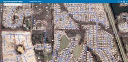
The city of Hernando in northwest Mississippi is one such municipality where the benefits of GIS are being explored.
Like many small towns, the city of Hernando struggled to maintain accurate records of its water infrastructure––above and below ground. Outdated information on paper maps led to contractors damaging pipes, and response to emergencies was hindered by a lack of accurate information about the city’s assets. When evaluating resource availability for new developments or repairing damage, the public works department had to contract for new surveys, which incurred added expenses and delays.
To develop a cost-effective solution, the city sought advice from GIS consulting firm Canopy Spatial based in Memphis, Tennessee, and Navigation Electronics, Inc., an authorized Trimble dealer with headquarters in Lafayette, Louisiana Canopy proposed a plan to combine base map information with newly collected GPS coordinates and detailed descriptions of assets to make the necessary information easily accessible in an online GIS.
“Our service area is about 40 square miles, and we’re responsible for ditch banks, sewer lagoons, thirty sewer lift stations, five water towers and everything related to the water system – valves, mains, storm drains,” said Lee Germany, the public works director for the City of Hernando. “Contractors were always hitting our lines because they weren’t properly marked, and it could take hours for us to locate breaks and determine where to turn off valves. We really needed a better method to know where our assets are located.”
After years of frustration with inaccurate as-built information that often led to damaged pipes and interrupted service, the city committed to developing a GIS in 2020. To start, existing data was compiled into a central database, enabling users to continuously upload new information and correct inaccuracies. For the collection of GPS coordinates, they selected the Trimble TerraFlex system.
The software, a cloud-based solution for field data collection that runs on an Android-based smartphone or an iPad, was used to map the diverse assets of the city. Field crews also use a GNSS receiver that provides 1─3 centimeter positioning accuracy. For added efficiency, the workflow pushes new data from the field to the office when online or stores data on the device if offline. The Trimble Connect Collaboration Platform and ArcGIS Online are used in the office to manage the data.
Making Progress
Starting in March 2021, they collected the locations of 2,583 water meters and 237 sewer/drainage manhole covers in five months. They also collected additional information describing assets, such as whether a sewer main is above or below ground and the size of the water tanks at the water plant; photographs provide extra visual details. The existing database is available to the field crew, so they don’t waste time re-entering duplicate information.
“I use the collaboration tool to build customized projects for the Hernando field crews to view on their TDC600 devices,” said Scott Trapolino, a project manager solutions specialist at Canopy Spatial. “The input form is set up to ask for very specific information, for example, water lines, and sub tabs ask for dimensions, direction of flow and other specifications. The customizable form speeds up the data input.”
Now field crews collect GPS coordinates and descriptions for important assets, such as water valves, water mains and storm drains, and they can remotely access the exact location of their crucial infrastructure, expediting repairs and maintenance. In addition to dedicated data collection efforts, GPS data is captured when old pipes are being repaired, and new subdivisions are required to provide accurate as-builts for infrastructure assets that are relevant to the public works department.
“We currently have all our water towers and stations mapped, and we’re continuing with meters, mains, and manhole covers,” said Germany. “Our customer service is improved because the GIS allows the crew to see how our assets are connected. They can quickly locate shut-off valves and calculate how many customers will be impacted by breaks. When called out to a site, they bring the right equipment to make the repairs instead of making multiple trips.”
The fast and efficient data collection process with the software encourages good maintenance of the GIS. Up-to-date GPS data, pictures and supporting notes aid long-term planning for new development and help enforce regulations intended to safeguard the community.
“Capturing data with TerraFlex enables us to populate our GIS with comprehensive asset information that we use to quickly locate problems, expedite our response and reduce any impacts on our customers,” said Germany. “We should finish collecting all our above-ground assets in 2021 or 2022 — it’s an ongoing process.”
An in-house GIS puts information at the fingertips of the people who need it most, to help them respond quickly and efficiently to service outages and routine repairs. With access to information, decision makers can answer their own questions about planned growth and sustainable development and make the best use of available resources.