NOAA expands flood inundation mapping tool to cover 60% of the U.S. population
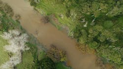
NOAA’s National Weather Service (NWS) has announced a major expansion of its experimental Flood Inundation Mapping (FIM) tool, which now serves 60% of the U.S. population – double the coverage from last year.
The FIM tool delivers near-real-time, high-resolution, street-level visualizations of floodwaters, helping NWS forecasters issue more accurate flood watches and warnings. New regions with FIM coverage include:
-
Hawaii and the West Coast
-
Portions of South Central Alaska, including the Cook Inlet, Kenai Peninsula, Copper River, and Prince William Sound
-
The Southwest and Great Plains
-
The Great Lakes and the interior Southeast
“Flooding is the most frequent severe weather-related threat, and our costliest natural disaster,” said David Vallee, director of the Service Innovation and Partnership Division at NOAA’s National Water Center, in a NOAA news release. “Expanding our FIM availability has been a game-changer in providing actionable, real-time information to emergency and water resource managers.”
Originally launched in 2023 to cover just 10% of the country, FIM has grown rapidly and is expected to reach full nationwide deployment by 2026, covering more than 110,000 forecast river miles and 3.6 million river miles modeled by the National Water Model.
The expanded maps are available on the National Water Prediction Service website and can be integrated into GIS applications.