Community app helps scientists monitor beach erosion
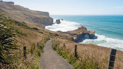
Scientists in New Zealand are using a community beach monitoring app to monitor erosion along one of its beaches.
As reporter Maddy Lloyds writes in an article from New Zealand-based 1News, Coastsnap is a tool that allows community members to upload photos, along a stretch of beach between St. Clair and St. Kilda, for scientists to analyze.
The app provides fixed phone stands on either side of the coastline for beachgoers to take their photos. 1News reports that the total cost to design and install the stands was just over $3,000.
“They’re low-cost, they’re unobtrusive, they’re always there so they provide a lot more data than we might otherwise be able to get just through our sort of scientific research,” Wayne Stephenson, an Otago University professor, tells 1News. “We can actually what we call geo-reference the photo and we can extract from the photograph where mean high tide is, for example; where the base of a dune is; where the top of the beach is.”
Coastal monitoring became work got underway as part of a coastal plan by nearby Dunedin city earlier this year. The images provide consistent data, which will help in making future decisions about the changing coastline.


